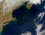
 This diagram illustrates ocean topography in the Northern Hemisphere resulting from the interaction of surface wind currents and the Coriolis Effect. To learn more about ocean topography from NASA, click here. Other factors effecting ocean topography are atmospheric pressure and bathymetric features.
Gulf of Maine
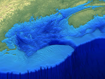
Bathymetry
Saturday, October 25, 2008
Ocean Topography
This diagram illustrates ocean topography in the Northern Hemisphere resulting from the interaction of surface wind currents and the Coriolis Effect. To learn more about ocean topography from NASA, click here. Other factors effecting ocean topography are atmospheric pressure and bathymetric features.
Subscribe to:
Post Comments (Atom)


No comments:
Post a Comment